
Foto Friday: Speed Bumps Designed Around Bicycle Riders
The photo below was taken by former San Diego resident Timur Ender who moved to Portland explicitly for Portland's commitment to making the city more bicycle friendly. Ender has been sending in a steady stream of photos that demonstrate that commitment and consideration made on behalf of the city's cyclists.

The image above is impressive because it demonstrates the level of thought and decision making that has gone into making bicycling in Portland that much more pleasant. With this sort of attention to detail, it's no wonder a tiny city like Portland can call itself the nation's most bicycle friendly city.
Update: BikeSD reader, Michael, states that these speed bumps are apparently for emergency vehicle ease of use. It just so happens that we have them here in Clairemont, per Oleg who also was kind enough to take some photos.
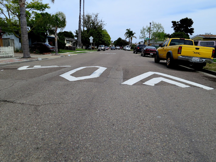
Foto Friday: A Little Repaving Makes You Go a Long Way (on Convoy Street)
Long time supporter Robert Leone sends us these photos taken on southbound Convoy Street nearing Mesa College Boulevard with this note,
These demonstrate how a simple little repaving can make life so much easier for people riding bikes.
Indeed, a bumpy ride suddenly got a little less bumpy.
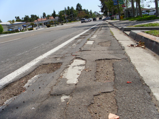
Foto Friday: The IRC Putting a Smile on the Newly Independent and Mobile
The International Rescue Committee (IRC) is an international organization that responds to the world’s worst humanitarian crises and helps people to survive and rebuild their lives. Here in San Diego, the IRC has a bicycle program which was established in October 2010. The goal of the program is to provide refugees with gently used and refurbished bicycles. The bike program operations depend largely on donation and all donated bikes are fixed by IRC-trained volunteers familiar with bicycle mechanics to ensure they are in good working conditions and safe for clients’ use. Over the past two years, the program has provided over 80 refugees with a bicycle for their commuting needs.
As the demand and request for bicycle continues to grow, the IRC welcomes donations of gently used bicycles. If you are interested in donating a bicycle, please contact Hong Tran at 619-641-7510 ext. 240 or Hong.Tran@Rescue.org
And the "Foto" for today? The smile of a newly mobile resident:
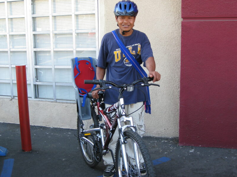
Foto Friday: The Case for Making the Urban Core and the Beach Communities more Bike Friendly
Below is an image of the map of San Diego depicted through bike collisions. This collision heat map depicts the collisions that involve a bicycle and was prepared for us by the very talented Joe Punsalan who works at the planning firm, KTU&A, and it was designed (for informational purposes) to show the density of car/bike collisions around the city between 2006 and 2010. To view the map in greater detail, you can view the pdf as well.

What does this map tell us? It indicates where people are both riding and getting hurt (or dying). The maps also demonstrates the need to prioritize implementing bicycle infrastructure projects in those parts of the city that have the highest rates of collisions. Not having the sort of infrastructure that separates bicycle traffic from motor vehicle traffic isn't good for the health or vitality of our city if our residents are getting hurt or dying. Our city's residents need to have the infrastructure that allows them to get around safely and comfortably and we're glad that both the North Park - Mid-City Regional Bike Corridors Project and the Uptown Regional Bike Corridor Project are both underway as part of SANDAG's 10 year early action projects - i.e. projects to be implemented in 10 years.
The next North Park - Mid-City Regional Bike Corridor Project meeting will be held on:
March 6, 2013
6 p.m. - 8:30 p.m.
Sunset Temple
3911 Kansas Street
San Diego, CA 92104
Here is the agenda for the meeting. On Monday we'll post our case for implementing protected bicycle infrastructure on El Cajon Boulevard.
Foto Friday: Riding into the New Year - Signs of Improvement in District 2
Article and photos by BikeSD member and supporter, Kelly Cummings.
---
 Way finding has been made easier for bicyclists with the addition of new signage. This example (above) is on the north side of the Sunset Cliffs Bridge over the San Diego River.
Late October 2012, BikeSD board member Nicole Burgess led San Diego City Senior Traffic Engineers Brian Genovese and Lynn Wade on an exploratory ride around Ocean Beach. Lynn Wade worked to document the need for way finding signage to help people navigate easily into the different areas of Ocean Beach by bicycle.

Below are some examples of the recent changes and additions to bicycle signage for way finding in the Ocean Beach area. There is much more than this going up around town. Have you noticed any new signs? Send us an image and location.


that helps to direct riders into specific areas of this beach community.
With the coming bike share program soon to roll out in San Diego, all this infrastructure improvement including signage, buffered bike lanes and improved road conditions will help to make San Diego a desirerable place to visit and live. Leveraging the good weather, natural beauty and terrific accommodations found in San Diego will help to make our city attractive to our "velo visitors", be they vacationers, conventioneers, business people and of course our local citizens.